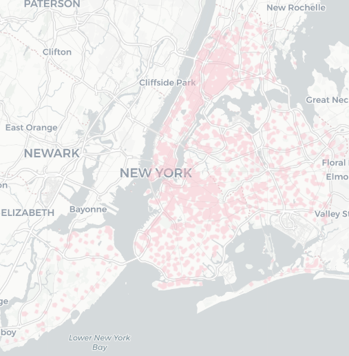
Mapping Intro 501
 Click the image to explore the map.
Intro 501 is a bill in the New York City Council that would allow people to report the obstruction of a bike lane/bus lane/etc by a vehicle, and creates a new civil penalty of a $175 ticket for that offense. However, it would only apply to vehicles within 1320 feet of a school building.
It’s hard to picture in my head how much of the city that covers, so I made an interactive map of the relevant areas.
The map was made using geopandas. More details are in the Github repository. School locations were taken from the 2019-2020 data on the NYC OpenData site, the latest year that I could find.
A few notes:
- The covered area is ~258km2 (99 square miles), about 32% of NYC’s landmass. A follow-up question on my mind is what proportion of NYC streets (or even specifically bike lanes) are covered.
- There’s a school on Governor’s Island.
- I certainly didn’t have a mental model of the distribution of schools across the city until I worked on this - an initial plan to also display the individual school locations was scuffed because of the sheer visual noise that added to the highest density areas.